
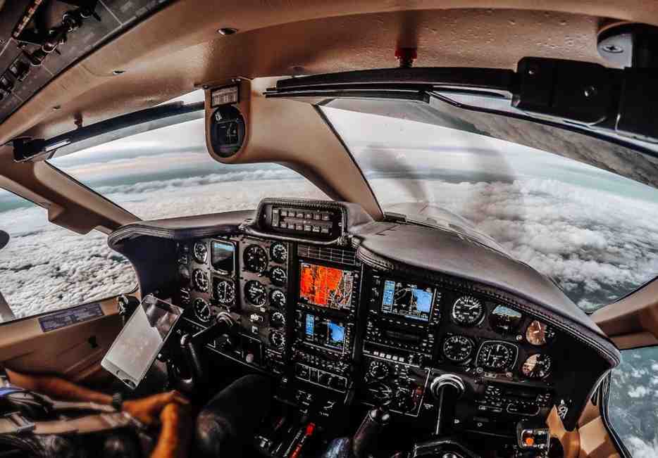
Aircraft navigation refers to the science and practice of determining an aircraft’s position and guiding it safely from one point to another. This process combines mathematics, technology, and pilot skill to ensure that every flight, whether short domestic hops or long transoceanic journeys, follows a precise and safe path. Without reliable aircraft navigation, modern aviation as we know it simply could not function. Pilots rely on a mix of instruments, satellite signals, and ground-based systems to calculate speed, altitude, direction, and distance. Over the decades, aircraft navigation has evolved from simple visual cues and compass readings to highly sophisticated computerized systems capable of guiding planes with pinpoint accuracy. This evolution has drastically improved safety standards while reducing pilot workload, allowing crews to focus more on decision-making and less on manual calculations during flight.
The Early Days of Flight Guidance
Before technology took over, pilots depended heavily on visual navigation, often called pilotage. This method involved identifying landmarks such as rivers, mountains, and roads to determine location. While effective in clear weather, it became unreliable during poor visibility or over featureless terrain like oceans and deserts. To address this, dead reckoning was introduced, where pilots calculated their position using known speed, heading, and elapsed time. Though useful, this method was prone to errors caused by wind drift and instrument inaccuracies. As aviation expanded, the need for more dependable aircraft navigation methods became evident, especially for military and commercial operations that required consistency regardless of weather conditions. These early techniques laid the foundation for the more advanced systems that would later transform how pilots find their way through the skies.
The Rise of Radio-Based Navigation
As air travel grew, radio navigation systems became essential tools for improving accuracy and reliability. Very High Frequency Omnidirectional Range, commonly known as VOR, allowed pilots to determine their bearing relative to fixed ground stations. Combined with Distance Measuring Equipment, pilots could calculate both direction and distance from a known point. Instrument Landing Systems further supported aircraft navigation by guiding planes safely during approach and landing, especially in low visibility conditions. These radio-based systems marked a significant leap forward, reducing reliance on visual references and dead reckoning. Airports worldwide began installing these ground stations, creating structured air routes that pilots could follow with confidence. This period represented a turning point where aircraft navigation began shifting from manual estimation to electronically assisted precision, setting the stage for satellite-based advancements.
Inertial Navigation Systems and Their Role
Inertial Navigation Systems, or INS, introduced a new level of independence in aircraft navigation by using internal sensors rather than external signals. These systems rely on accelerometers and gyroscopes to track an aircraft’s movement from a known starting point. Because INS does not depend on ground stations or satellites, it proved invaluable for long-haul flights over oceans and remote regions where radio signals were unavailable. However, inertial systems have a notable limitation: small errors accumulate over time, gradually reducing accuracy during extended flights. Despite this drawback, INS became a cornerstone of aircraft navigation for decades, often paired with other systems to cross-check and correct positional data. Even today, many aircraft use inertial navigation as a backup system, ensuring continuity in the eventuality of satellite signal loss or radio interference.
Satellite Navigation and the GPS Revolution
The introduction of satellite technology fundamentally transformed aircraft navigation. The Global Positioning System, developed initially for military use, became widely adopted in civil aviation due to its remarkable accuracy and global coverage. GPS allows aircraft to determine their exact position, altitude, and speed in real time by receiving signals from multiple satellites orbiting the Earth. This technology significantly reduced the burden of manual calculations and minimized the risks associated with human error. Modern aircraft navigation systems now integrate GPS with other technologies to create a more resilient and accurate overall system. Airlines and regulatory authorities have embraced satellite-based navigation because it supports more direct flight routes, reduces fuel consumption, and enhances safety margins. As satellite constellations continue to expand and improve, the reliability of aircraft navigation continues to strengthen accordingly.
Area Navigation and Performance-Based Navigation
Beyond basic satellite positioning, the aviation industry has developed advanced concepts such as Area Navigation, known as RNAV, and Performance-Based Navigation, or PBN. These frameworks allow aircraft to fly custom routes rather than being restricted to fixed paths between ground stations. This flexibility improves airspace efficiency, reduces congestion, and allows for more direct routing between destinations. Performance-Based Navigation sets specific accuracy and reliability standards that aircraft must meet, ensuring consistent safety levels across different regions and operators. These systems represent a major shift in how aircraft navigation is approached, moving away from rigid corridors toward a more flexible, technology-driven model. Airports and air traffic control centers benefit from this approach as well, since it allows for smoother traffic flow and reduced delays, particularly in busy airspace regions.

The Role of Flight Management Systems
Flight Management Systems, commonly referred to as FMS, act as the central computer brain behind modern aircraft navigation. These systems integrate data from GPS, inertial sensors, and other onboard instruments to calculate the most efficient route, monitor fuel consumption, and manage speed and altitude profiles. Pilots input flight plans into the FMS, which then continuously updates navigation data throughout the journey. This integration reduces pilot workload significantly, allowing for more precise control over complex flight paths. The FMS also plays a critical role in fuel efficiency by calculating optimal cruising altitudes and speeds based on real-time conditions. As aircraft navigation technology continues to advance, flight management systems are becoming increasingly intelligent, incorporating predictive analytics and automated adjustments to enhance both safety and operational efficiency across various flight phases.
Comparing Traditional and Modern Navigation Methods
The table below highlights key differences between traditional and modern aircraft navigation approaches, showing how technology has reshaped flight guidance over time.
| Aspect | Traditional Navigation | Modern Navigation |
|---|---|---|
| Primary Tools | Compass, landmarks, maps | GPS, satellites, computers |
| Accuracy | Moderate, prone to drift | High, real-time precision |
| Weather Dependency | High | Low |
| Route Flexibility | Limited, fixed corridors | Flexible, direct routing |
| Human Workload | Heavy manual calculation | Reduced through automation |
| Reliability Over Long Distances | Decreases over time | Consistently accurate |
This comparison illustrates why aircraft navigation has shifted so heavily toward satellite and computer-based solutions, offering safer and more efficient journeys for both passengers and cargo operations worldwide.
Redundancy and Safety in Navigation Systems
Given the critical nature of aircraft navigation, redundancy plays a vital role in ensuring safety. Aircraft typically carry multiple navigation systems simultaneously, so if one fails or provides inaccurate data, others can compensate. For instance, an aircraft may rely on GPS as its primary source while maintaining inertial navigation and radio-based systems as backups. This layered approach minimizes the risk of complete navigational failure, even during technical malfunctions or signal interference. Regulatory bodies mandate strict standards for these backup systems, particularly for commercial aviation, to guarantee passenger safety. Pilots are also trained extensively to cross-check data from multiple sources, ensuring that no single point of failure compromises the flight. This redundancy-focused philosophy has become a defining characteristic of how aircraft navigation is structured across the aviation industry today.
Challenges Facing Modern Aircraft Navigation
Despite significant technological progress, aircraft navigation still faces several challenges that engineers and regulators continue to address. Signal interference, whether from natural atmospheric conditions or intentional jamming, can disrupt satellite-based systems, posing risks to flight accuracy. Cybersecurity threats have also emerged as a growing concern, as navigation systems become more digitally integrated and potentially vulnerable to hacking attempts. Additionally, congested airspace in major regions demands increasingly precise navigation to prevent conflicts between aircraft. Environmental factors such as magnetic pole shifts can also affect compass-based instruments, requiring periodic recalibration. Addressing these challenges requires continuous innovation, international cooperation, and strict regulatory oversight. As air traffic volumes increase globally, the pressure to enhance aircraft navigation systems further intensifies, pushing researchers to explore next-generation solutions for safer skies.
The Future Outlook for Aircraft Navigation
Looking ahead, aircraft navigation is expected to become even more autonomous and intelligent. Emerging technologies such as artificial intelligence and machine learning are being explored to predict potential navigational errors before they occur, enhancing proactive safety measures. Integration with next-generation satellite constellations promises even greater accuracy and global coverage, particularly benefiting remote and polar routes. Additionally, advancements in quantum navigation technology, though still experimental, could eventually offer alternatives that do not rely on external signals at all, addressing vulnerabilities associated with satellite interference. As the aviation industry continues to modernize, aircraft navigation will likely become more automated, resilient, and precise, supporting the growing demands of global air travel while maintaining the highest safety standards possible.
Conclusion
Aircraft navigation has undergone a remarkable transformation, evolving from simple visual guidance to highly sophisticated satellite and computer-driven systems. Each stage of this evolution has contributed to safer, more efficient, and more reliable air travel. From early dead reckoning techniques to modern GPS integration and flight management systems, the journey of aircraft navigation reflects the broader progress of aviation technology as a whole. While challenges such as signal interference and cybersecurity remain, ongoing innovation continues to strengthen the systems pilots depend on every day. As the industry moves toward greater automation and intelligent integration, aircraft navigation will remain at the heart of aviation safety, ensuring that millions of flights reach their destinations accurately and securely across the world’s increasingly busy skies.